
Sensor Details
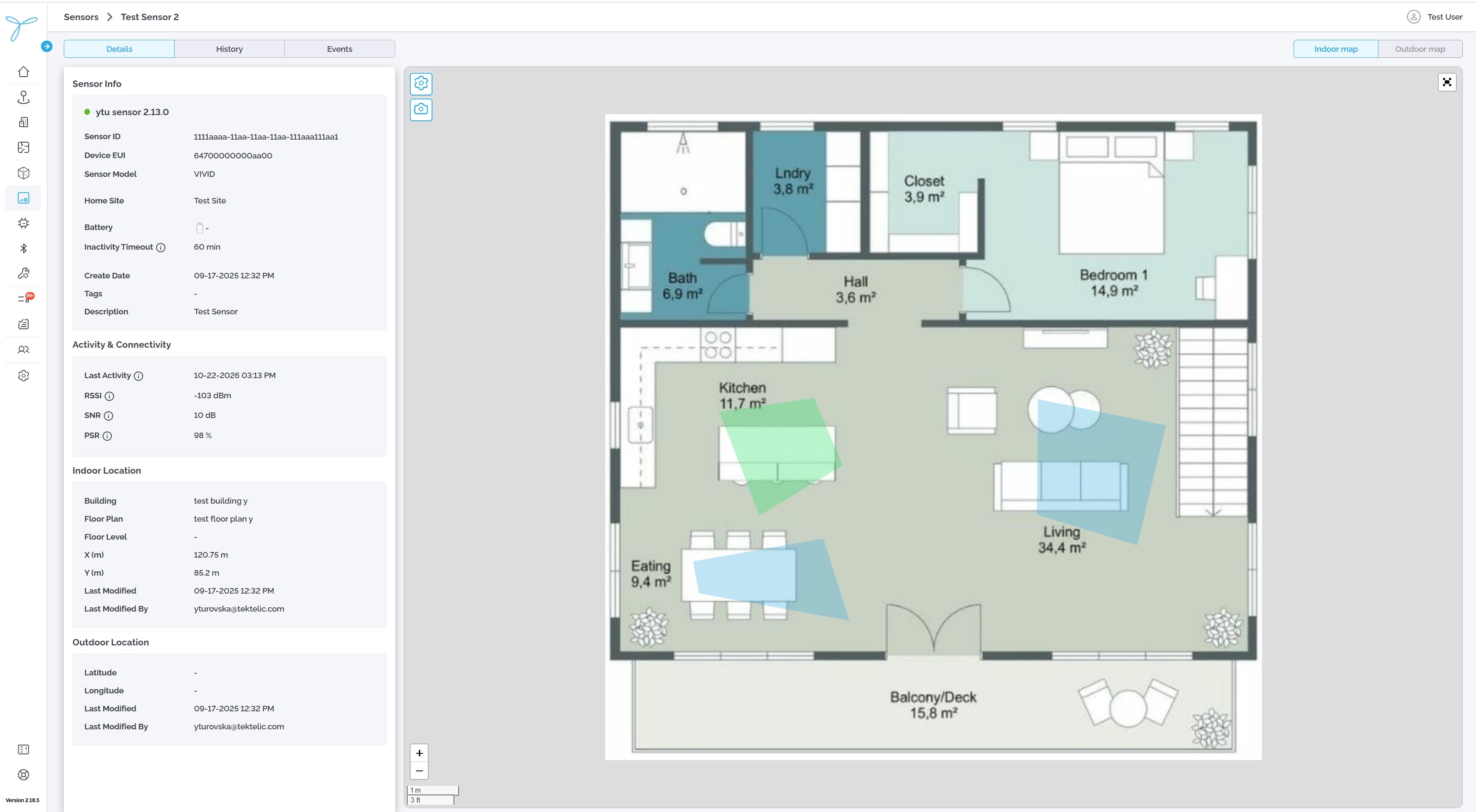
The Details tab shows identification, connectivity, and location information for a selected sensor.
- Select Sensors from the left navigation menu.
- Select a sensor in the list.
- Review the Details tab. Select the Sensors breadcrumb to return to the list.
Use the History and Events tabs to review measurements and events for the same sensor.
| Field | What it means |
|---|---|
| Sensor Status | Current status indicator. |
| Sensor Name | Display name. |
| Sensor ID | Internal sensor identifier. |
| Device EUI | Device identifier, where applicable. |
| Sensor Model | Sensor model. |
| Home Site | Assigned Home Site. |
| Battery | Available battery information. |
| Inactivity Timeout | Configured inactivity period, in minutes. |
| Create Date | When the sensor record was created. |
| Tags / Description | Optional labels and notes. |
| Field | What it means |
|---|---|
| Last Activity | Most recent recorded sensor activity. |
| RSSI | Received signal strength, in dBm. |
| SNR | Signal-to-noise ratio, in dB. |
| PSR | Packet success rate, when available. |
Hover over an information icon, when present, to see an explanation of the field.
Indoor Location may show Building, Floor Plan, Floor Level, X (m), Y (m), Last Modified, and Last Modified By.
Outdoor Location may show Latitude, Longitude, Last Modified, and Last Modified By.
- Find the map on the Details tab.
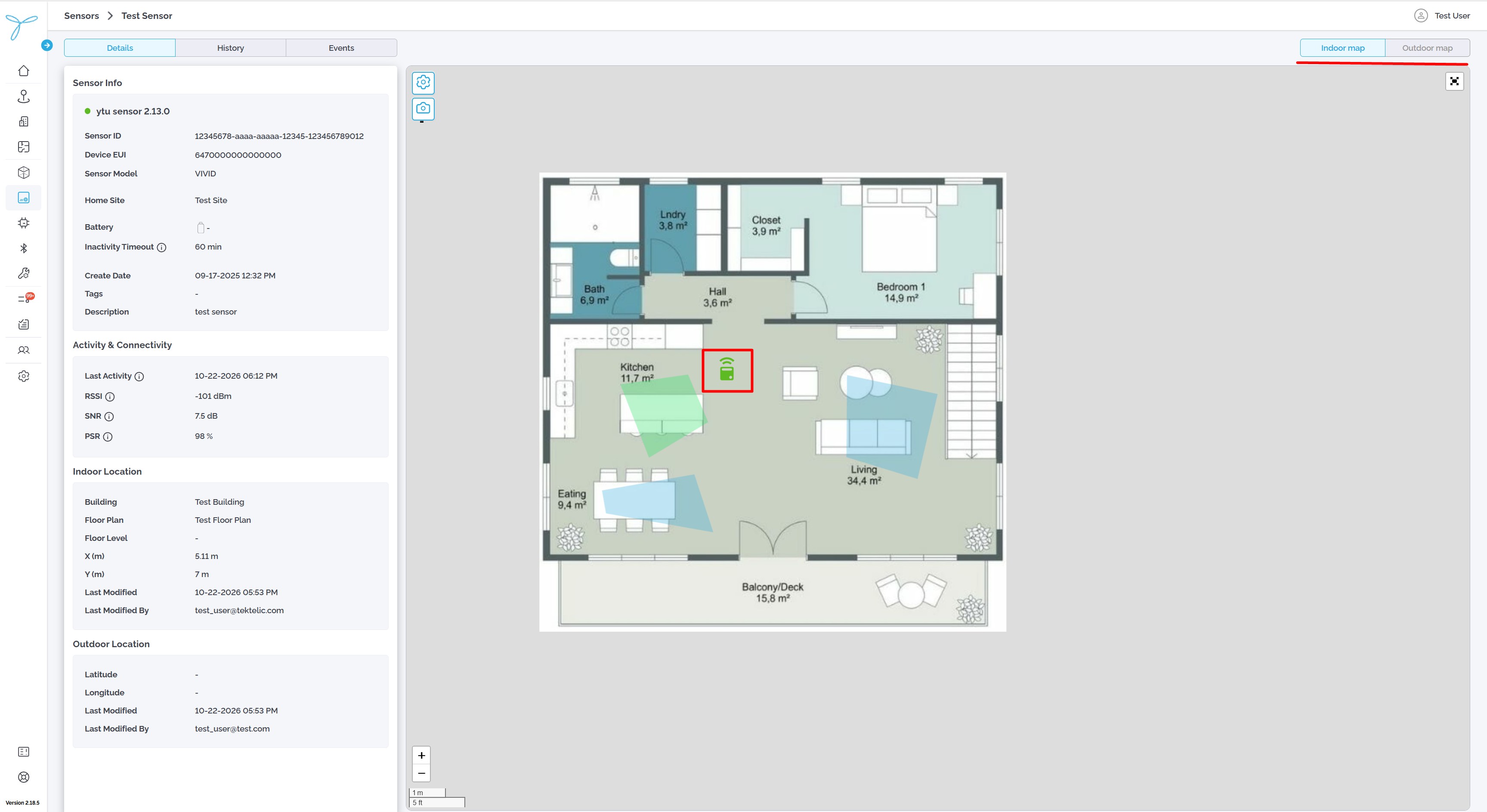
- Review the sensor marker at its latest available location.
- If both are available, switch between Indoor map and Outdoor map.
A map type may be unavailable if the sensor has no corresponding location or you do not have access to it. Selecting the marker on this Details map does not open a separate information panel.
In addition to the map on an individual sensor’s Details tab, you can browse sensors on maps from Home.
- From Home, open the relevant Site or Building outdoor map.
- Select the Sensors tab.
- Find the sensor in the list beside the map.
- Select the sensor to highlight its location on the map.
The outdoor sensor list can show Status, Sensor Name, Sensor Model, Battery, Latitude, Longitude, Tags, and available measurement values. It is sorted by Sensor Name by default. Use its search, filter, column settings, export, and pagination controls as needed.
Where available, Open sensor history opens the sensor’s History page in a new browser tab.
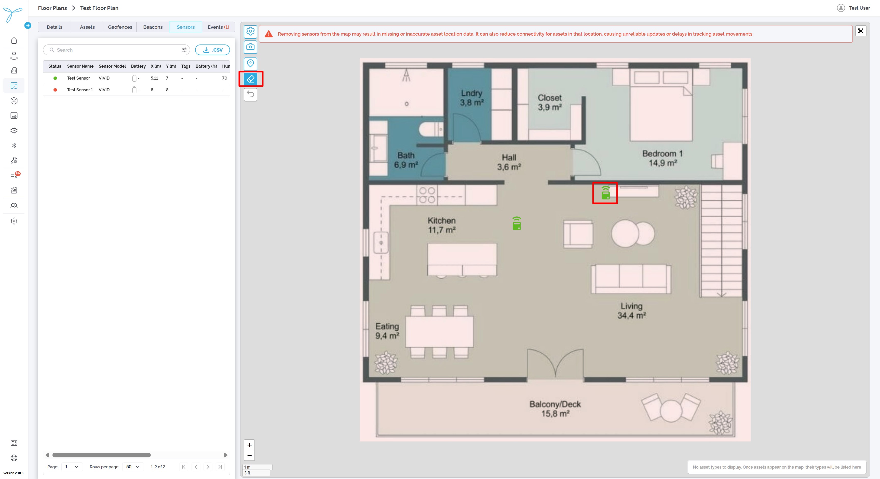
- From Home, open the relevant indoor floor plan.
- Select the Sensors tab.
- Find the sensor in the list or on the floor plan.
- Select it to identify its position.
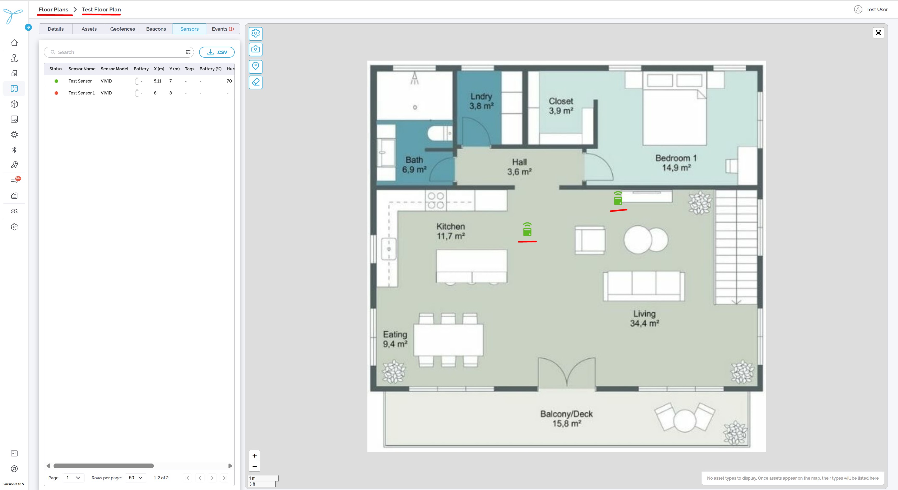
Only sensors in locations you have permission to view are shown.
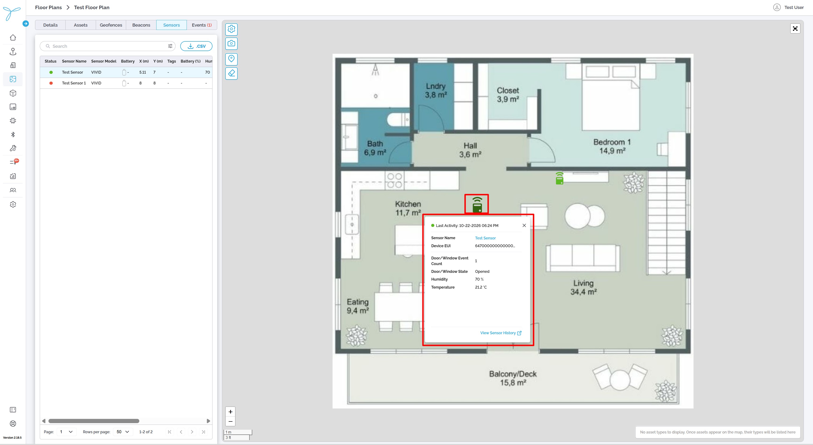
On maps that support marker selection, select a sensor marker to see available information, such as Sensor Name, Device EUI, Status, Last Activity, and recent valid measurements.
Select the sensor name in the marker information to open Sensor Details. Parameters without valid readings may not appear in the marker information.
Use the map visibility controls to show or hide available layers, such as Sensor Markers, Asset Markers, Geofence Areas, and Building Markers (outdoor maps).
If you have the required write permissions, the map may offer Draw Mode (Marker) to reposition a sensor marker or Delete Mode to remove it.
Important: Removing a map marker or its location is not the same as deleting the sensor record. Use the sensor management controls to delete a sensor.
Details refresh approximately every 30 seconds. A dash (-) means a value is unavailable. If information appears outdated, check Last Activity and whether the sensor has recently reported data.